The Seismic Refraction Method
The seismic refraction method provides information that can be
used in:
- mapping bedrock topography
- determining the depth of gravel, sand or clay deposits
- delineating perched water tables
- determining the depth to the water table
- detecting subsurface caverns
- estimating rippability
- detecting shallow faults and fracture zones
- detecting large boulders
- monitoring time-varying changes in elastic properties
Seismic refraction explorations consist of measuring the
time required for a seismic impulse to travel from a seismic source
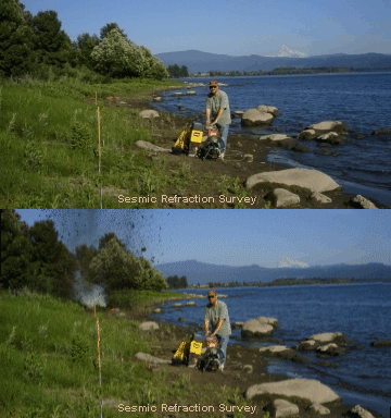
to a receiving transducer. An explosive device, an air gun, a weight
dropped from a truck or a hammer striking a steel plate is typically
used for the seismic source and twelve or more vertical geophones
are used for the receiving transducers. The choice of the seismic
source depends upon the length of the seismic line, the degree of
resolution desired, and the environmental suitability of a
particular source.
A signal enhancement seismograph records signals from the geophones.
By analyzing the arrival time of the seismic wave as a function of
distance from the seismic source, the seismic velocities
 of
the underlying soil/rock units and the depth to geologic contacts
can be determined. The geophone spacing and the distance between the
seismic source and the first geophone are designed to obtain the
needed penetration and resolution. Application of the method is
generally limited to areas where seismic velocity increases or is
constant with depth.
Earth Dynamics uses
state-of-the-art forward and inverse modeling and ray
tracing techniques to analyze seismic refraction data. The
modeling techniques can detect both lateral and vertical variations
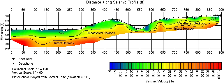
in seismic velocity. An example of a seismic refraction model is shown below.

