Electromagnetic Methods
An Electromagnetic survey is useful for locating buried ferrous and non-ferrous material. Electromagnetic Methods are:
- Cost effective. Large sites are surveyed quickly and easily.
- Non-destructive and non-invasive
- Extremely portable and environmentally neutral
- On site real-time data allows for preliminary anomaly identification
Electromagnetic (EM) induction uses a transmitter to generate a
pulsed primary magnetic field. The transmitted magnetic field
induces eddy currents in nearby ferrous and non-ferrous metallic
objects. The EM measuring device senses the eddy current fields. The
amplitude and phase of the eddy current fields are related to the
electrical properties of the subsurface.
There are two types of Electromagnetic Induction techniques commonly
used. These are time-domain and frequency-domain.
Time Domain Electromagnetic Induction
The time-domain instrument produces a short low energy
electromagnetic pulse from the transmitter coil. A receiver coil
measures the decaying signal induced into the ground as a function
of
time. The rate of decay is related to the electrical
conductivity of the subsurface materials.
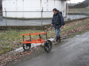
 EM
61 Survey EM
61 Survey |
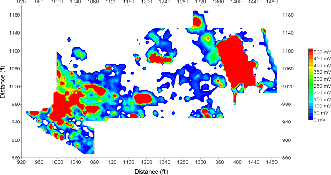
On completion of each survey the data are downloaded to a computer for processing. The data are used to produce site maps showing the locations and sizes of detected anomalies.
The time domain method allows very sensitive detection of shallow and deep buried metal objects It is capable of detecting and mapping the location of both ferrous and non-ferrous buried metallic objects, large or small. Typically, a single buried 55-gallon drum can be detected to depths of 3 meters.
Frequency Domain Electromagnetic Induction
The frequency domain instrument normally operates at a fixed frequency. The generated signal creates small subsurface eddy currents beneath the instrument. Automatic accurate measurements of the components of the generated subsurface eddy currents are then used to record changes in the subsurface soil conditions.
The frequency domain method is capable of detecting and mapping any contaminant plume that is causing even a small change in soil conductivity/resistivity. It can be used to find buried dumpsites, leachate plumes, voids, underground streams and aquifers and buried metallic/magnetic objects.
 EM response contour plot. Red indicates high electromagnetic response. Buried drums were excavated from most of these anomalies. |
