Magnetic Methods
Magnetic surveys can provide information useful for the following
applications:
- Site Evaluations: Locating buried objects containing ferrous metal such as drums, tanks, unexploded ordinance and utilities.
- Geologic Surveys: Identifying changes in bedrock or soil conditions, locating faults and/or dikes.
 Magnetic surveys provide a cost-effective means for quickly
providing whole-site or specific-area investigations. Magnetometers
are highly portable, therefore, surveys can be conducted over uneven
terrain.
Magnetic surveys provide a cost-effective means for quickly
providing whole-site or specific-area investigations. Magnetometers
are highly portable, therefore, surveys can be conducted over uneven
terrain.
A magnetic survey accurately measures the earth's magnetic field.
Objects containing ferrous material create local perturbations in
the earth's field.
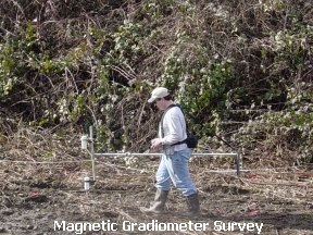
A magnetic gradiometer consists of a magnetometer equipped with two
sensors. The sensors are placed in a vertical orientation to measure
the vertical gradient in the earth’s magnetic field, or they can be
placed in a horizontal configuration to measure the horizontal
gradient. A gradiometer is ideally suited for detection of shallow
ferromagnetic material because the gradiometer accentuates the
signal from objects which are at shallow depth while ignoring
distant features. In a gradiometer survey, no corrections are needed
for diurnal changes in the earth’s magnetic field because the
diurnal changes affect both sensors equally.
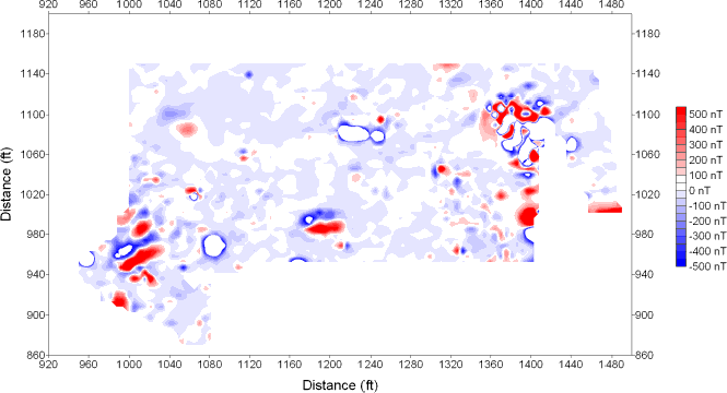 Magnetic gradiometer contour plot. Magnetic anomalies are indicated by the bright red and blue areas. Hazardous waste drums were excavated from most of these anomalies. |